
Lantau Peak Sunrise Hike: The Hong Kong Dawn Trail Worth the 4am Alarm
Photo by Sassy Hong Kong

The alarm goes off at 3:45am. You take the MTR to Tung Chung, still half-asleep. The 4:50am bus climbs out of the new town into the dark.
By the time the first light reaches the Pearl River Delta, you are already above it.
The Lantau Peak hike in Hong Kong is most commonly done before dawn — and that is not a quirk. It is the whole point. At 934 metres, Hong Kong's second-highest peak sits high enough to watch the sun rise over the South China Sea from above the cloud line, with planes descending into Hong Kong International Airport below you and the outline of the coast emerging in the grey before the colour comes in. It is one of the finest dawn experiences in the city.
Trail Overview: Lantau Peak (Fung Wong Shan)

Lantau Peak — Fung Wong Shan, Phoenix Mountain — is one of 26 trails in the Iconic Hikes Hong Kong book and poster series. It is Hong Kong's second-highest summit, 934 metres above sea level, and sits on the northern edge of South Lantau Country Park.
- Elevation: 934 metres
- Distance: approximately 4km return from Pak Kung Au to the summit
- Duration: 1.5 to 2 hours ascent, 1 to 1.5 hours descent
- Difficulty: Hard — steep rocky stairs, exposed in places
- Trailhead: Pak Kung Au, Lantau Island
- Best time: October to April for the clearest views; year-round for the sunrise experience
The trail begins at Pak Kung Au — a pass on the mountain road between Tung Chung and South Lantau. From here, a marked Lantau Trail section (Section 3) ascends steeply via rocky stone stairs for approximately 1.2km before the gradient eases toward the summit plateau.
Getting to Lantau Peak: The Sunrise Bus
For a sunrise summit, you need to be at Pak Kung Au approximately 90 to 120 minutes before dawn — which, in winter months, means leaving Tung Chung by 4:50am.
By MTR and bus: Take the MTR to Tung Chung Station (Tung Chung Line). From Tung Chung Bus Terminal (Exit B), board New Lantao Bus 3M, 11 or 23 towards Ngong Ping or Mui Wo and alight at Pak Kung Au — the stop at the top of Tung Chung Road before the bus descends into South Lantau. The bus fare is around HKD 17 on Octopus.
For the earliest buses (departing before 6am), check the New Lantao Bus schedule carefully — not all services start that early, and the schedule varies on weekdays versus weekends. Weekend buses to Ngong Ping tend to start earlier due to demand from sunrise hikers.
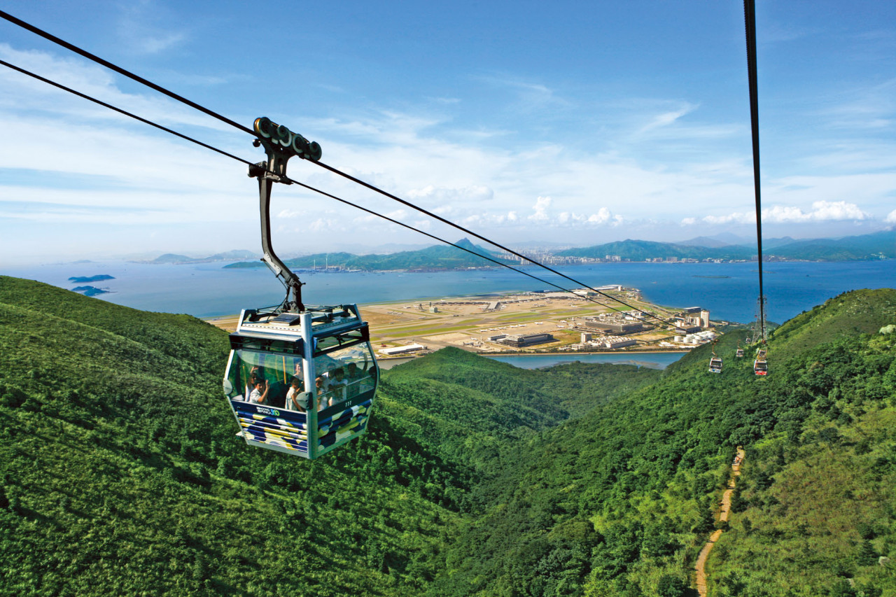
Plan for the descent: After the summit, many hikers continue along Lantau Trail Section 3 towards Ngong Ping, where you can take a cable car (Ngong Ping 360) or bus back to Tung Chung. This makes a natural half-day circuit and avoids retracing the steep ascent route. The descent to Ngong Ping is gentler than the ascent from Pak Kung Au and passes through open grassland with sustained views south toward the sea. Allow an additional 60 to 90 minutes for this section.

Photo by Pelago
The Lantau Peak Hike: What to Expect on the Trail

Photo by Wikimedia Commons (Pak Kung Au)![]()

The first 45 to 60 minutes from Pak Kung Au are the hardest. The stone stairs are steep and the ascent is relentless — there is no gentle warm-up section on this trail. In the dark, before dawn, the staircase seems endless.
Around 700 metres the gradient eases. The trail opens onto the upper plateau and the first views appear. In clear weather you can see Tung Chung and the new town below, the airport bridge to the west, and the lights of Zhuhai and Macau on the horizon if the visibility is good. The summit itself is a broad, open ridge with a few rock outcrops marking the highest point.
The temperature at the top is 10 degrees cooler than the valley floor at minimum — more in winter. Bring a windproof layer, not just a light jacket. On winter mornings the summit can be genuinely cold by Hong Kong standards, and the wind is consistent.
From the summit, the 360-degree view:
- West: Pearl River Delta, the HKIA bridge, Macau on clear days
- East: Hong Kong Island, Victoria Peak, Kowloon beyond it
- North: Tung Chung, the Lantau lowlands, the airport
- South: the South China Sea, Cheung Chau and Lamma Island
Sunrise from this elevation, when the cloud is below the summit, produces the specific quality of light that makes the trail famous — the city emerging below you as colour fills in from the east, the airport lights going dark as daylight arrives, planes appearing as moving points below the cloud line.
When to Hike Lantau Peak: Season and Conditions
October to April gives you the best visibility and the most comfortable temperature for the steep ascent. November to February are the clearest months — low humidity and stable weather produce the longest visibility from the summit.
In summer (June to September), sunrise hikes are possible but the cloud is more frequent and views are less reliable. The ascent in summer heat is significantly more demanding. If you hike in summer, start no later than 5am and carry significantly more water than in winter — at least 2 litres per person for this trail.
Do not attempt the trail in poor visibility, heavy rain, or when a typhoon signal is in effect. The upper sections are exposed and the stone stairs become treacherous when wet. For more on summer hiking conditions, read Summer Hiking in Hong Kong: How to Beat the Heat.
Frequently Asked Questions: Lantau Peak Hike Hong Kong
How hard is the Lantau Peak hike?
Hard. The ascent is steep and sustained on rocky stone stairs with little respite. The trail requires good physical fitness and appropriate footwear. This is not a beginner trail — see the easy hikes guide if you are new to hiking in Hong Kong.
How long does the Lantau Peak hike take?
Allow 1.5 to 2 hours for the ascent from Pak Kung Au to the summit. Descent takes 1 to 1.5 hours on the same route. If you continue to Ngong Ping add another 1 to 1.5 hours. Total time for a sunrise to Ngong Ping circuit: 4 to 5 hours.
Is Lantau Peak or Tai Mo Shan higher?
Tai Mo Shan is higher at 957 metres. Lantau Peak reaches 934 metres. Both offer above-cloud summit experiences in humid weather. Tai Mo Shan is more accessible by public transport; Lantau Peak is more dramatic for sunrise due to its position above the airport and Pearl River Delta. Read the Tai Mo Shan trail guide to compare the two.
Can you see the sunrise from Lantau Peak?
Yes, and it is what the trail is known for. On clear mornings the sunrise from the summit above the cloud line is exceptional. The east-facing view from the summit takes in Hong Kong Island and the South China Sea. Peak clarity is from October to March.
What is the best bus to take to Lantau Peak?
New Lantao Bus 3M, 11 or 23 from Tung Chung Bus Terminal (MTR Tung Chung Exit B) to Pak Kung Au. For a sunrise summit, the 4:50am bus (when running) puts you at the trailhead by approximately 5:15am. Check current schedules at the New Lantao Bus website before your visit, as early morning services vary by day.
Lantau Peak (Fung Wong Shan) is one of 26 trails in the Iconic Hikes Hong Kong book — the coffee table book and poster series celebrating Hong Kong's trail landscape. Trail art prints available in A1, A2 and A3.