
Tai Mo Shan Hike Hong Kong: To the Top of the City
Photo by Time Out

Hong Kong's highest point is 957 metres above sea level. Most people who live here have never stood on it.
Tai Mo Shan — Big Hat Mountain — sits in the New Territories, well above the cloud layer in summer. The name is apt. On humid mornings, the upper half of the mountain is often invisible from below, wrapped in moving cloud that thins and reforms as you climb through it. The city below disappears.
The Tai Mo Shan hike in Hong Kong offers something the more-visited trails don't: genuine altitude, real weather, and a landscape that feels nothing like the city 45 minutes away by MTR. This is the complete guide to getting there, which route to choose, and what to expect at the top.
Trail Overview: The Tai Mo Shan Hike
Tai Mo Shan is one of 26 trails in the Iconic Hikes Hong Kong book and poster series. It is Hong Kong's highest peak and the dominant feature of Tai Mo Shan Country Park in the central New Territories. Three main routes reach the summit; each has different characteristics and different access points.
- Duration: 2 to 3 hrs
- Summit elevation: 957 metres
- Difficulty: Moderate to hard, depending on the route
- Best time: October to March — cooler, better visibility. In summer the summit is often cloud-covered, which has its own character.
- Temperature: Significantly cooler than the city — bring a layer even in summer; the summit can be 10 degrees cooler than the valley floor
Three Routes Up Tai Mo Shan: Which to Choose
Route 1 — Via the Visitor Centre (shortest, most popular): Take Bus 51 from Tsuen Wan MTR to the Tai Mo Shan Road stop near the Rotary Club campsite and Country Park Visitor Centre. From here, it is approximately 5km along a paved road to the radar installation at the summit. The road is driveable in parts but the upper sections are restricted to pedestrians. This is the lowest-effort route but also the least interesting scenically — you walk a road rather than a trail for most of the distance.
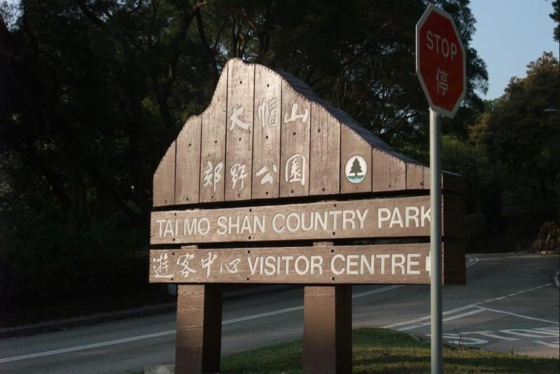
Photo by Hong Kong
Route 2 — Via Ng Tung Chai (north side, most scenic): Begin with the Ng Tung Chai waterfall trail from Tai Po Market MTR (Bus 64K) and continue up from the Main Fall through the forest to the ridge. This approach links two of the most rewarding sections of Tai Mo Shan Country Park in one day and is the route that earns the most trail kilometre for its effort. Allow a full day. Read the Ng Tung Chai trail guide for the access and lower section details.
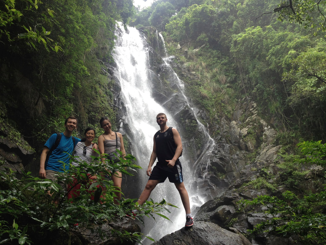
Photo by Wild Hong Kong
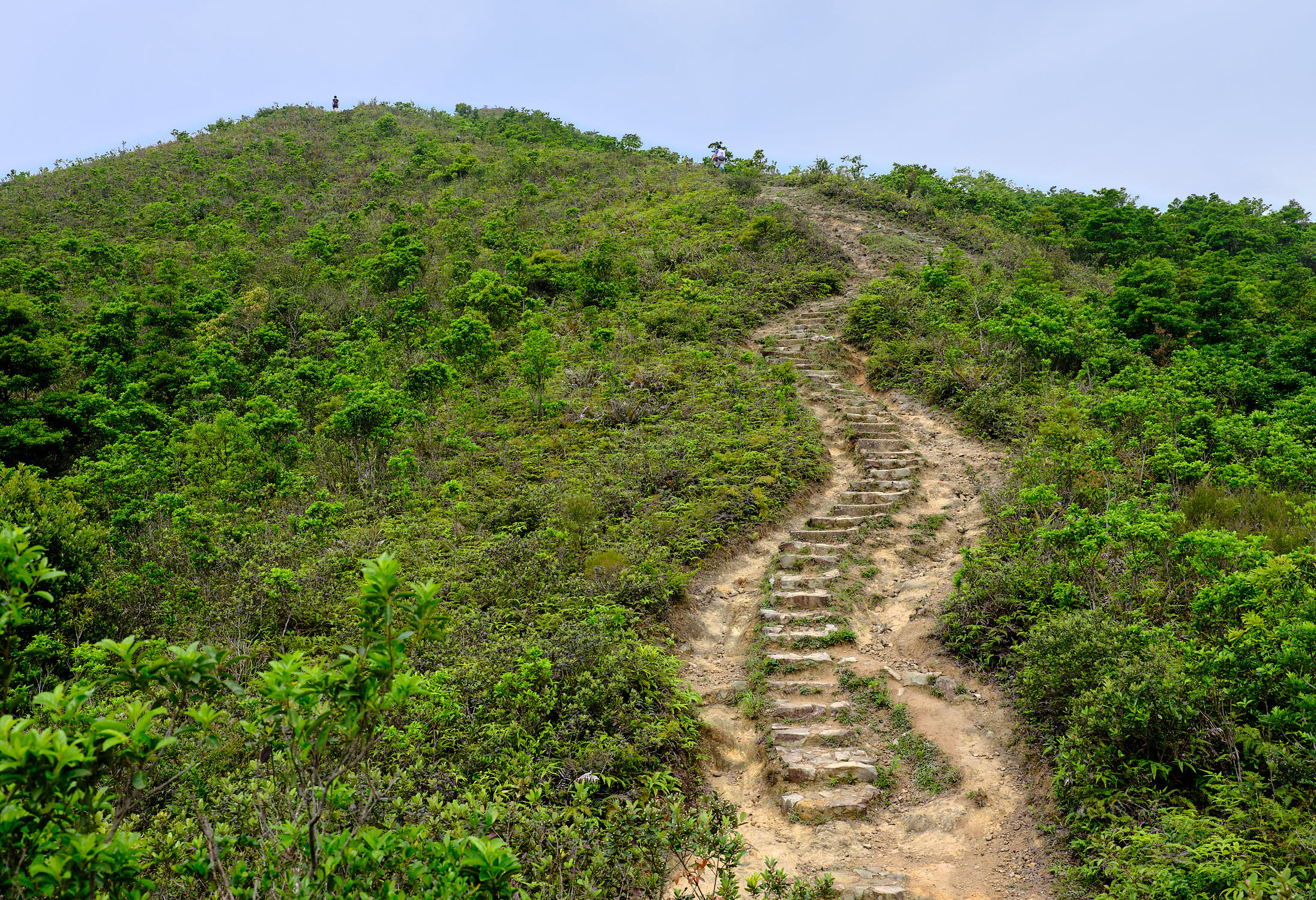
Route 3 — Via MacLehose Trail Section 8 (most demanding): MacLehose Stage 8 approaches from Lead Mine Pass and follows the ridge to the summit before descending to Route Twisk on the western side of the mountain. Access to Lead Mine Pass is via Bus 64K from Tai Po Market MTR. The ridge section is fully exposed with limited markers in places — a map and clear weather are both necessary. This is the most demanding option and is best attempted by experienced hikers in good weather with navigation skills and a full day available.

Photo by fcracer.com
At the Top: Wh![]() at You Find at the Summit of Hong Kong
at You Find at the Summit of Hong Kong
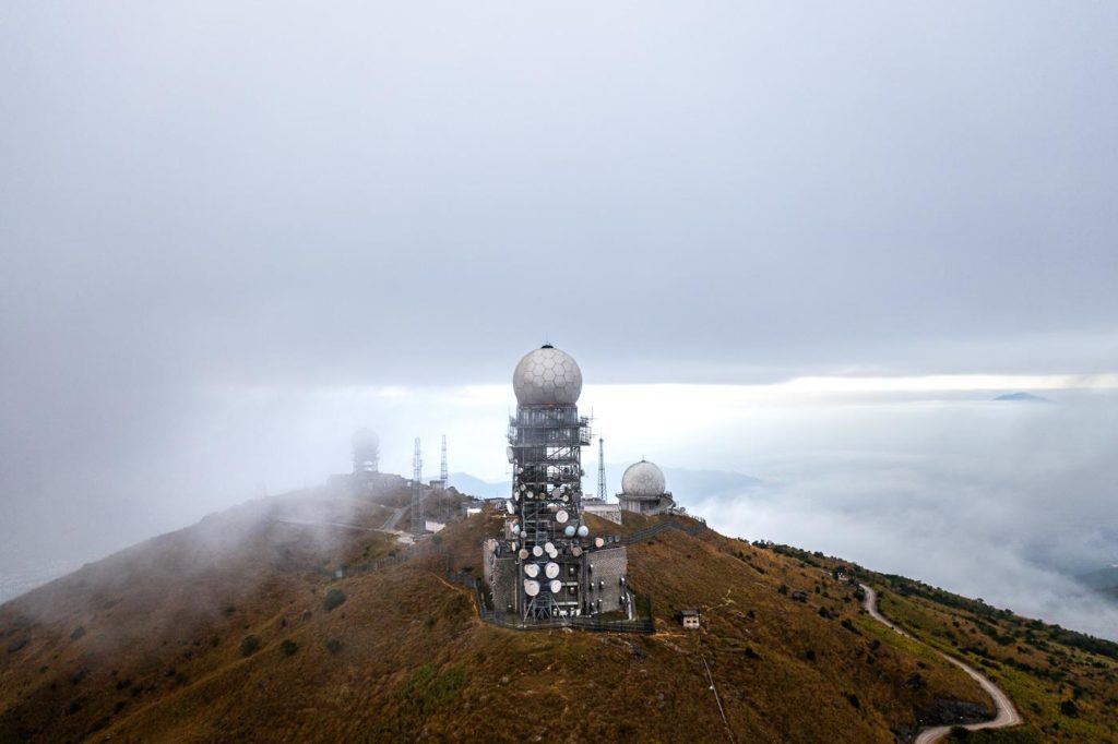
Photo by Jouney Era
The summit of Tai Mo Shan is not a dramatic pinnacle. It is a broad plateau with a radar installation and communication towers. The highest accessible point is a short distance from the road — a rocky outcrop at [VERIFY: exact highest accessible point, summit coordinates] that gives you the full 360-degree view when cloud permits.
In clear winter conditions, the view from the top is remarkable: Lantau to the southwest, Kowloon below you, Hong Kong Island beyond, and the Pearl River Delta to the northwest. You can see China.
In summer, the cloud sits at around 700 to 800 metres and you spend the upper portion of the ascent inside it. The city below vanishes. The temperature drops noticeably. The landscape turns grey-green and quiet. It is a different kind of hike entirely — not panoramic, but genuinely atmospheric.
Take a windproof layer regardless of the season. The summit is almost always windy and the temperature is significantly cooler than the valleys below. In winter, gloves are not unusual. The radar installation and communication towers, which dominate the summit area, are a reminder that despite the solitude of the upper ridge, you are still within the operational footprint of a major international city. The contrast is part of what makes the Tai Mo Shan summit distinctive.
When to Hike Tai Mo Shan and How to Prepare
For the best views, hike Tai Mo Shan between October and March. Clear winter days with low humidity give you long visibility across the New Territories and towards Lantau. Sunrise attempts are popular in winter and worth the early start.
In summer, the cloud is a feature rather than a drawback for those who accept the trade-off. The summit temperature in July is often 10 to 15 degrees cooler than Central, which makes it one of the more bearable summer hikes — especially on the longer scenic routes where you spend most of the time in forest cover before emerging above the cloud line.
What to bring:
- A windproof layer or light jacket — even in summer
- At least 2 litres of water per person
- Trekking poles for the steeper descent routes
- Proper hiking footwear — the MacLehose route in particular has rocky, uneven surfaces
- A fully charged phone — signal can be weak near the summit
For summer hiking advice on preparation, timing and heat management, read Summer Hiking in Hong Kong: How to Beat the Heat.
Frequently Asked Questions: Tai Mo Shan Hike Hong Kong
How high is Tai Mo Shan?
957 metres above sea level — Hong Kong's highest peak. It is significantly taller than Lion Rock (495m) or Dragon's Back (284m), and just above Lantau Peak (934m). The altitude is noticeable: weather conditions at the summit frequently differ from the valleys below.
How long does the Tai Mo Shan hike take?
Via the Visitor Centre route, allow 4 to 5 hours return. Via Ng Tung Chai, plan a full day of 6 to 7 hours including the waterfall stops. Via MacLehose Section 8, experienced hikers typically take 5 to 6 hours for the full section.
Can you drive to the top of Tai Mo Shan?
The road leading to the summit is restricted to authorised vehicles only. Hikers access it on foot from the Visitor Centre area. There is no public vehicle access to the summit.
Is Tai Mo Shan suitable for beginners?
The Visitor Centre route is manageable for reasonably fit beginners on a clear day. The road walk is long but not technically demanding. The Ng Tung Chai and MacLehose routes are not suitable for beginners — both involve significant elevation gain and exposed terrain. For beginner-appropriate trails, read the easy hikes guide.
What is special about hiking Tai Mo Shan in summer?
In summer, the cloud layer often sits below the summit. You hike through the cloud and emerge above it — the city below disappears and you are in a quieter, greener, cooler world. It is the most atmospheric version of the hike, even if the views are replaced by cloud. The temperature at the summit in July can be genuinely cool, which makes it unusual among Hong Kong summer hikes.
Tai Mo Shan is one of 26 trails celebrated in the Iconic Hikes Hong Kong book — the coffee table publication and poster series that gives Hong Kong's natural landscape the cultural recognition it has always deserved. Trail art prints in A1, A2 and A3.